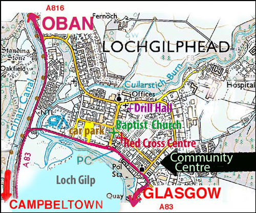
Location of the Community Education Centre, Manse Brae, Lochgilphead.
Location of the Community Education Centre, Manse Brae, Lochgilphead.
Parking is allowed in the streets (apart from yellow lines along part of Manse Brae) and in the Library car park next to the centre.
Also shown is the location of the Baptist Church (corner of Union Street and Argyll Street), Red Cross Centre (Union Street) and Drill Hall (Manse Brae).
Road map produced from the Ordnance Survey Get-a-map service. Image reproduced with kind permission of Ordnance Survey.
go back to top close this window go to club competitions page
All photographs on this web site are copyright, & may not be copied without permission of their photographer (who may be contacted through this site).
We try to be legal, decent, honest & truthful, & to present fair opinions and accurate facts. Please email any corrections.
We comply with the General Data Protection Regulations 2016-679: see our data protection policy
Search all MACC pages here for anything, eg your images and personal data:
www.macc.ukphotographers.com/map.html last modified 27/04/2022 by Dutyhog.